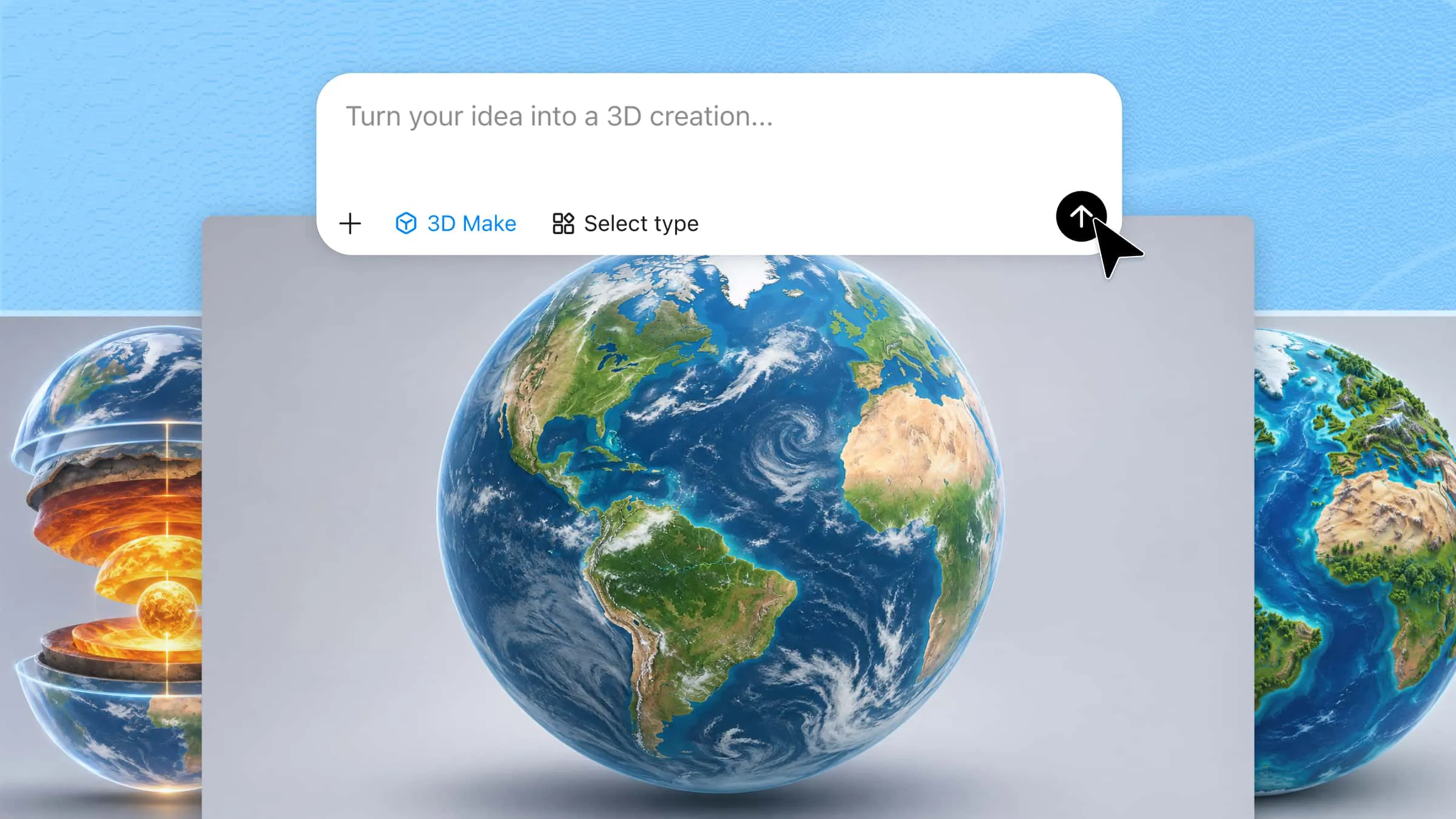
A 3D Earth model can present our planet in different ways, from realistic geographical details to creative scientific and futuristic designs. Each style serves a different purpose, whether you are preparing a school project, developing a scientific presentation, or creating digital artwork. However, choosing the right design and building it from scratch can require time and 3D modeling skills. This guide explores 10 creative Earth 3D model ideas and explains how to create them.
Overview of 3D Earth models
Each type of Earth model presents the planet from a different perspective, depending on the details and purpose of the design. Some focus on geographical features, while others illustrate Earth's internal structure or offer creative visual interpretations. The table below compares all 10 models, their main features, and their common uses.
| 3D Earth model | Key features | Main focus | Suitable for |
|---|---|---|---|
| Realistic Earth model | Continents, oceans, clouds, and natural textures | Earth's appearance from space | Educational and scientific projects |
| Political Earth model | Country borders, territories, and color-coded regions | Countries and geographical divisions | Geography lessons and presentations |
| Topographic Earth model | Elevation levels, valleys, mountains, and ocean trenches | Surface height and depth | Terrain studies and science projects |
| Nighttime Earth model | Illuminated cities, dark oceans, and atmospheric glow | Urbanization and population distribution | Science presentations and visual projects |
| Cutaway Earth model | Crust, mantle, outer core, and inner core | Earth's internal composition | Science lessons and geology projects |
| Historical Earth model | Ancient continents and prehistoric oceans | Earth's geological past | Geology and history projects |
| Physical Earth model | Mountains, plains, deserts, and ocean basins | Natural landforms | Geography and school projects |
| Futuristic Earth model | Digital grids, glowing networks, and data points | Technology and global connectivity | Technology presentations and digital artwork |
| Low-poly Earth model | Angular polygons and simplified landforms | Stylized representation of Earth | Games, illustrations, and animations |
| Holographic Earth model | Transparent surfaces, glowing outlines, and digital grids | Digital visualization of the planet | Science exhibitions and technology presentations |
Explore 10 3D Earth models for your projects
The appearance of Earth can vary greatly depending on the purpose of your project. You might need a realistic globe for a geography presentation, a cutaway model to explain the planet's internal layers, or a futuristic design for digital artwork. Kimi 3D Make helps you generate a realistic Earth 3D model from text prompts or reference images. Let's explore 10 Earth model ideas and how to create them in Kimi 3D Make.
Realistic 3D Earth model
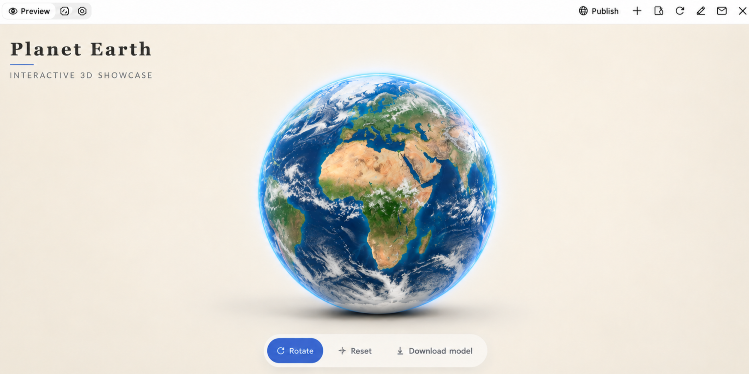
A realistic Earth model shows the planet with recognizable continents, oceans, clouds, and natural colors. It works well for educational presentations, geography projects, and scientific visualizations. You can use this planet earth 3D model to illustrate Earth's appearance from space, with detailed surface textures and natural lighting.
How to use
Step 1: Enter your prompt
Visit Kimi 3D, open the 3D model creation tool, and describe the Earth model you want to generate. Include details about its surface, continents, oceans, clouds, and lighting.
Example prompt:
Step 2: Let AI generate your 3D model
Kimi 3D will use your prompt to generate the model. Review the initial result to see whether the continents, surface details, and overall appearance match your requirements.
Step 3: Review and export the 3D model
Inspect the model from different angles and check its surface details. Make any necessary refinements, then export the finished model for your project.
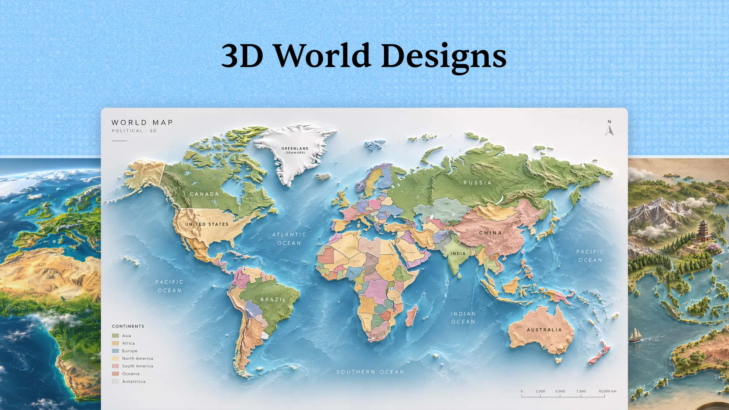
Political 3D Earth model
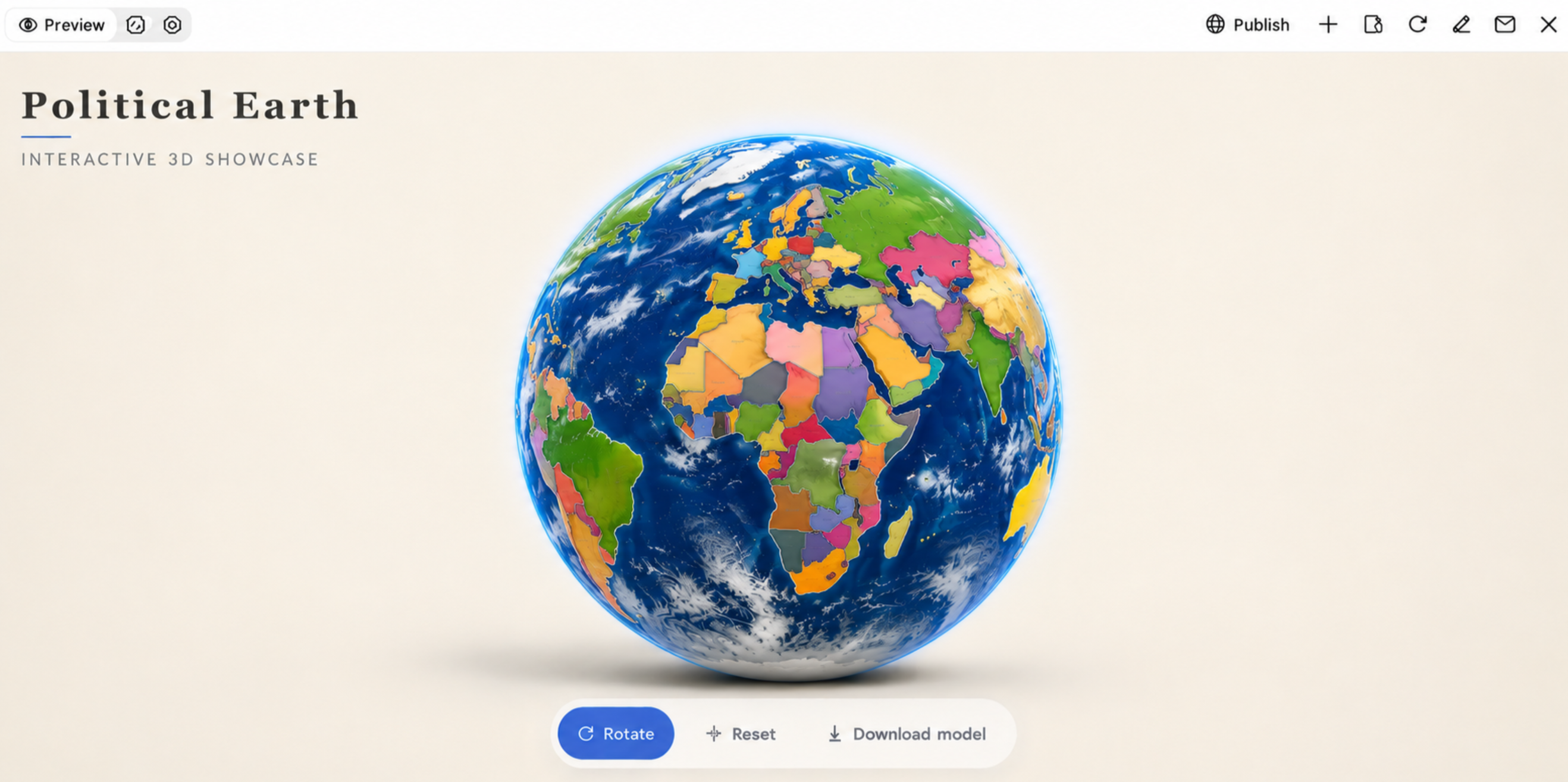
A political Earth model highlights country borders, national territories, and geographical divisions across the globe. Different colors can distinguish countries and make regional boundaries easier to identify. This 3D model of Earth is useful for geography lessons, classroom demonstrations, and projects about international regions.
How to use
Step 1: Enter your prompt
Open Kimi 3D and describe the political features you want to include. Specify country borders, national territories, color distinctions, and the overall educational appearance.
Example prompt:
Step 2: Let AI generate your 3D model
Allow Kimi 3D to interpret the prompt and build the model. Check whether the country divisions and color differences are visible and easy to understand.
Step 3: Review and export the 3D model
Examine the borders and regional divisions from different viewpoints. Refine the appearance if needed and export the model for educational or presentation use.
Topographic 3D Earth model
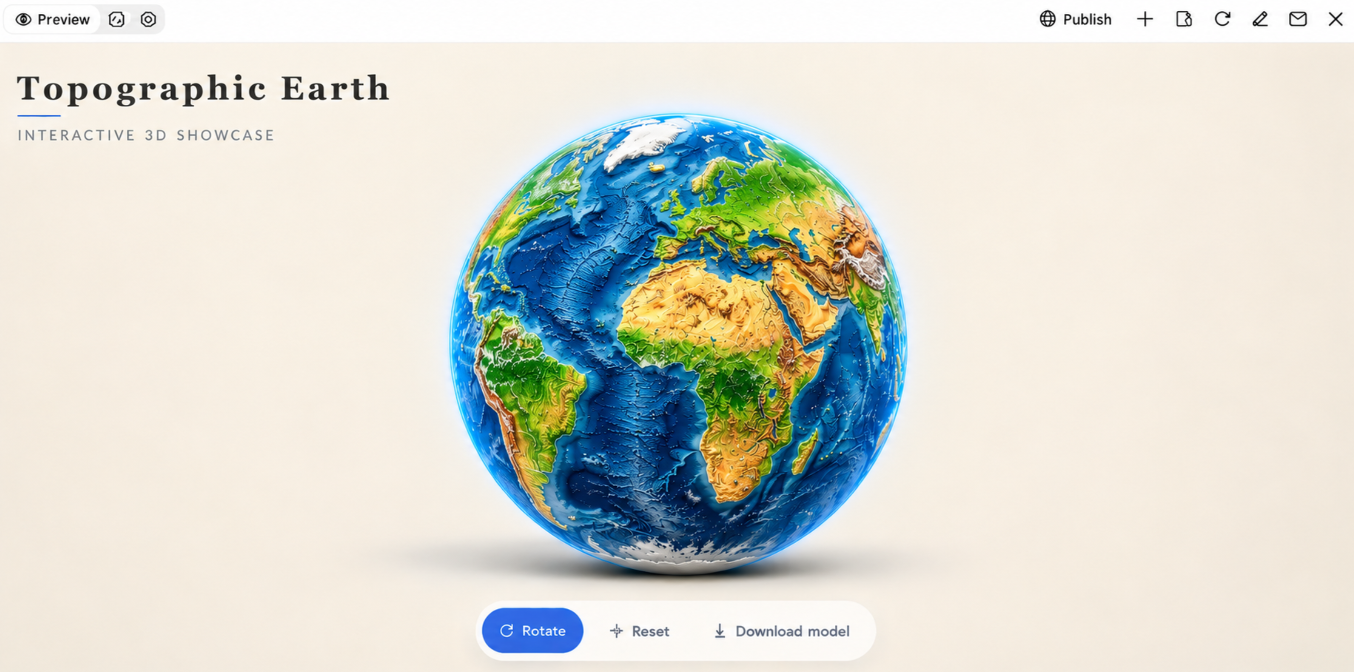
A topographic Earth model emphasizes changes in elevation across the planet's surface. Raised mountain ranges, deep valleys, plateaus, and ocean trenches help viewers understand variations in Earth's terrain. A realistic Earth 3D model with elevation details can support geography lessons, terrain studies, and science projects.
How to use
Step 1: Enter your prompt
Open Kimi 3D and describe the elevation details you want to show. Include raised mountains, lower valleys, plateaus, and ocean trenches to create a clear topographic representation.
Example prompt:
Step 2: Let AI generate your 3D model
Kimi 3D will create a model based on the terrain details you describe. Check whether elevated and lower regions are represented clearly.
Step 3: Review and export the 3D model
Inspect the raised and recessed areas from different angles. Refine the terrain details if required, then export the model for your presentation or project.
Nighttime Earth model
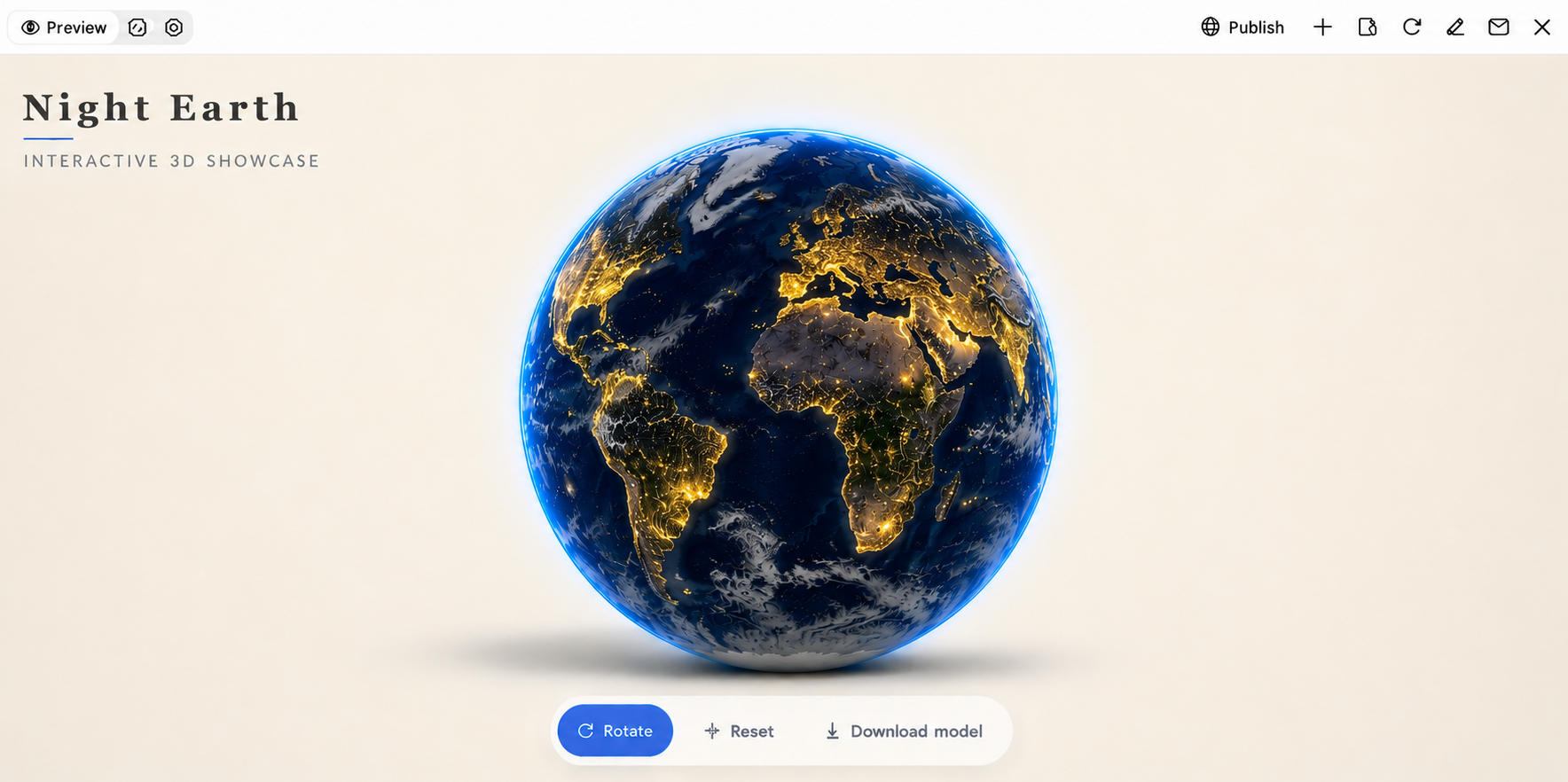
A nighttime Earth model displays the planet after dark, with illuminated cities and populated regions standing out against darker land and oceans. Glowing urban areas create a striking view of human activity across different continents. This design can help explain population distribution, urbanization, and the impact of artificial lighting.
How to use
Step 1: Enter your prompt
Go to Kimi 3D and describe how the planet should look at night. Include illuminated cities, dark oceans, atmospheric lighting, and the level of realism you want.
Example prompt:
Step 2: Let AI generate your 3D model
Let Kimi 3D generate the illuminated globe. Review the placement and appearance of city lights, along with the contrast between the planet's surface and the dark background.
Step 3: Review and export the 3D model
Rotate the model to examine the illuminated regions. Adjust the lighting or surface details as needed, then export your final design.
Cutaway Earth model
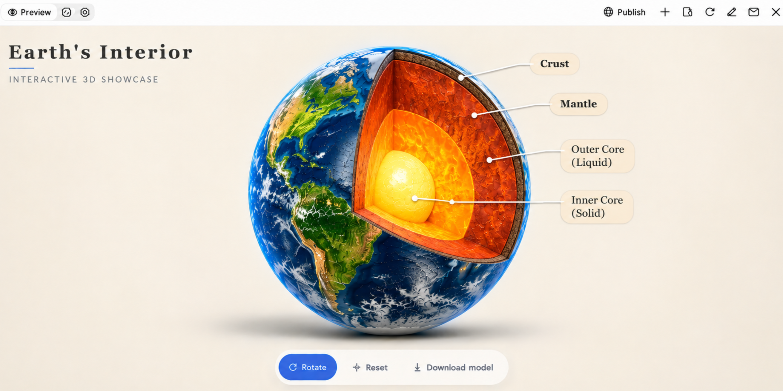
A cutaway Earth model reveals the planet's internal structure by showing a section removed from its outer surface. It can display the crust, mantle, outer core, and inner core as distinct layers with different colors and textures. This Earth 3D model project is particularly useful for explaining Earth's composition and structure in science classes.
How to use
Step 1: Enter your prompt
Open Kimi 3D and specify that the model should reveal Earth's internal structure. Mention all four layers and explain how you want them visually separated.
Example prompt:
Step 2: Let AI generate your 3D model
Kimi 3D will generate the cutaway design from your description. Check that all four internal layers are visible and arranged in the correct order.
Step 3: Review and export the 3D model
Inspect the exposed cross-section and make sure the layers are clearly separated. Refine the colors or shapes before exporting the model.
Historical Earth model
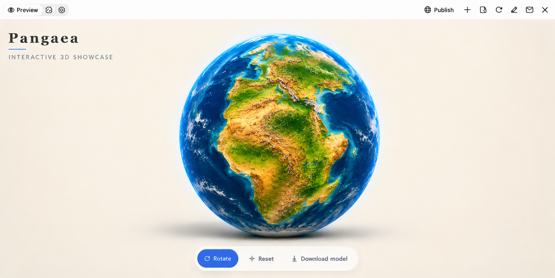
A historical Earth model can represent the planet during an earlier geological period, when continents and oceans had different arrangements. For example, a model of Pangaea can show how most landmasses were connected before continental drift separated them. It is useful for teaching geological history, plate tectonics, and the changing shape of Earth's surface.
How to use
Step 1: Enter your prompt
Visit Kimi 3D and describe the geological period you want to represent. Include the arrangement of ancient continents, surrounding oceans, and terrain details.
Example prompt:
Step 2: Let AI generate your 3D model
Allow Kimi 3D to generate a historical representation. Review the arrangement of the landmasses and check whether the overall design reflects the requested geological period.
Step 3: Review and export the 3D model
Examine the continental arrangement and surface details. Make any necessary changes, then export the model for your geology or educational project.
Physical 3D Earth model
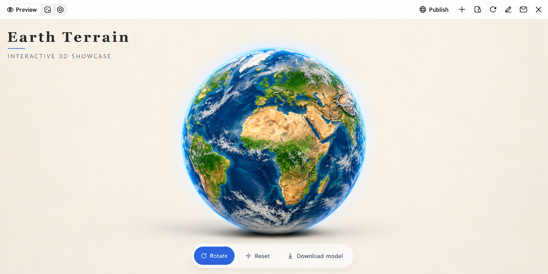
A physical Earth model focuses on natural geographical features, including mountains, plains, deserts, valleys, and ocean basins. Its surface can use different colors and textures to distinguish landforms and water bodies. This design is suitable for explaining Earth's physical geography and creating an Earth 3D model project for school or university.
How to use
Step 1: Enter your prompt
Visit Kimi 3D and explain which natural landforms and geographical features should appear on the globe.
Example prompt:
Step 2: Let AI generate your 3D model
Submit the prompt to Kimi and let it generate the model based on the geographical features in your instructions.
Step 3: Review and export the 3D model
Rotate the model to inspect its geographical details. Make adjustments to the colors or terrain appearance, then export it for your project.
Futuristic Earth model
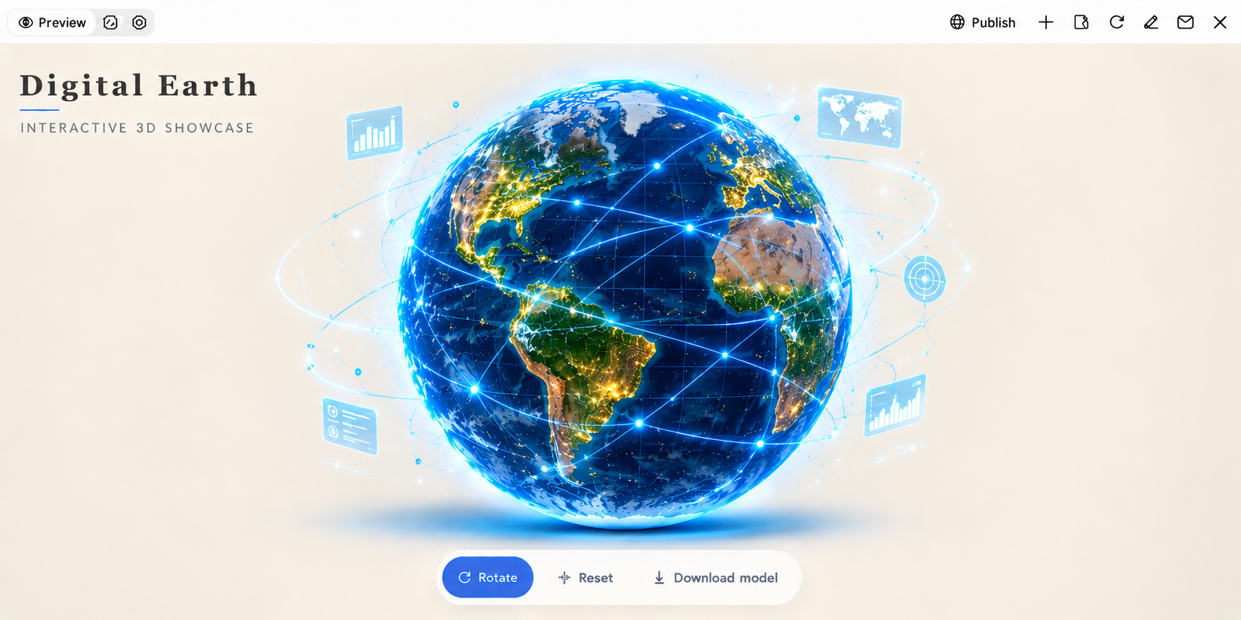
A futuristic Earth model presents the planet through a technology-inspired design, often featuring glowing networks, digital grids, and connected data points. It can represent global communication, smart cities, environmental monitoring, or advanced technology. This creative style is a good choice for technology presentations, digital artwork, and conceptual projects.
How to use
Step 1: Enter your prompt
Open Kimi 3D and describe the technology-inspired appearance you have in mind. Specify digital grids, glowing connections, data points, and the lighting style.
Example prompt:
Step 2: Let AI generate your 3D model
Kimi 3D will interpret your description and generate a futuristic globe. Review the digital patterns, lighting, and network details to see whether they match your concept.
Step 3: Review and export the 3D model
Inspect the model from different angles and refine its visual effects if needed. Export the final version for your digital presentation or creative project.
Low-poly Earth model
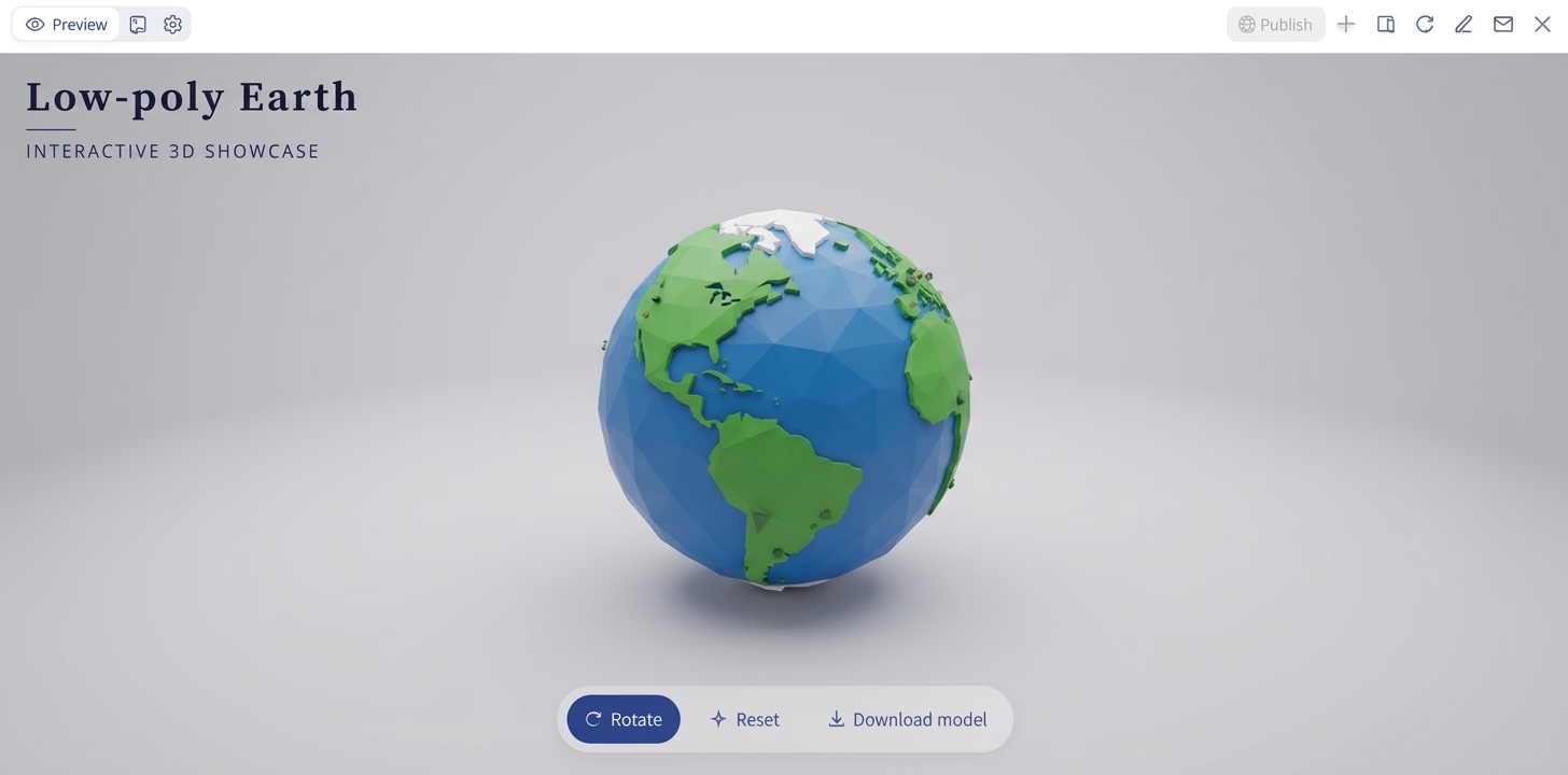
A low-poly Earth model uses simple geometric shapes and flat surfaces instead of detailed textures. Its angular appearance gives the planet a clean, stylized look that works well for illustrations, animations, and game environments. You can also use this design when creating a free 3D model of Earth for a lightweight visual project, depending on the tool's export and usage options.
How to use
Step 1: Enter your prompt
Visit Kimi 3D and describe the geometric style you want for the globe. Mention polygon shapes, colors, surface details, and the overall artistic appearance.
Example prompt:
Step 2: Let AI generate your 3D model
Wait for Kimi 3D to generate the geometric design. Check the polygon shapes, color distribution, and overall appearance of the globe.
Step 3: Review and export the 3D model
Rotate the model to examine its geometric surfaces. Adjust the colors or polygon details, then export it for your design or animation project.
Holographic Earth model
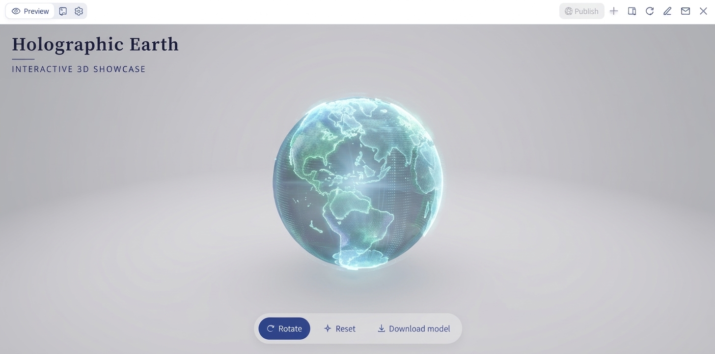
A holographic Earth model gives the planet a futuristic, floating appearance through glowing outlines, transparent surfaces, and luminous details. It can include digital latitude and longitude lines, orbiting data points, and blue or cyan light effects. This style is suitable for technology presentations, science exhibitions, and digital concept artwork.
How to use
Step 1: Enter your prompt
Open Kimi 3D and describe the holographic effects you want to include. Specify transparent surfaces, glowing outlines, digital grid lines, and the background.
Example prompt:
Step 2: Let AI generate your 3D model
Kimi 3D will generate the holographic design from your prompt. Review the transparency, glowing outlines, and digital details to ensure the planet has the intended appearance.
Step 3: Review and export the 3D model
Examine the globe from different angles and refine its lighting or holographic effects. Once satisfied with the result, export the model for your presentation or creative project.
Why use Kimi 3D Make to create 3D Earth models
With Kimi 3D Make, you can turn your Earth model ideas into 3D assets using text prompts or reference images. The tool also lets you refine generated designs and export them for different creative workflows. Here are the key features that make it useful for creating 3D Earth models.
Text prompts and reference images for flexible generation: Kimi 3D Make supports both text-to-3D and image-to-3D generation. You can describe the Earth's appearance, surface details, colors, textures, and visual style in a prompt or upload reference images to guide the creation process. This makes it easier to turn different Earth model concepts into 3D assets.
Create realistic Earth-inspired 3D designs: Kimi 3D Make supports creating 3D Earth models with recognizable continents, naturally shaped coastlines, expansive oceans, mountain ranges, and varied terrain. Explore realistic planetary proportions, accurate geographic layouts, and detailed surface textures to capture the appearance of our planet.
Prompt-based editing for easy adjustments: Kimi 3D Make supports follow-up instructions to modify generated models. You can request changes to colors, surface textures, terrain details, proportions, or overall appearance without having to describe the entire model again, making design refinement more convenient.
Multiple export formats for different workflows: Generated 3D Earth models can be exported in formats such as GLB and BLEND. These files can be imported into compatible 3D software and visualization workflows for further editing, rendering, or use in creative projects.
Where are 3D Earth models used
3D Earth models make geographical concepts easier to visualize and explain across various fields. Here are some of their common applications:
Education and classroom learning
Teachers use 3D Earth models to explain continents, oceans, climate zones, and geographical features. Cutaway and topographic models also help students understand Earth's internal layers and surface elevations. These visual aids make complex topics easier to follow and support interactive classroom activities.
Scientific research and data visualization
Researchers use 3D Earth models to present geographical, environmental, and climate-related data. They can visualize terrain, ocean patterns, atmospheric changes, and geological structures in three dimensions. Such representations help make scientific findings easier to interpret and communicate.
Game development
Game developers incorporate 3D Earth models into simulation games, strategy games, and virtual environments. These models can represent realistic landscapes, continents, cities, and natural environments. Developers can also customize terrain and geographical details to create more immersive gaming experiences.
Film and animation
Film studios and animation creators use 3D Earth models to produce space scenes, educational videos, and visual effects. Detailed textures, lighting, clouds, and atmospheric effects help create convincing planetary visuals. Animated models can also illustrate events such as satellite movement, global weather patterns, or changes in the Earth's surface.
Architecture and urban planning
Architects and urban planners use 3D Earth models to understand how buildings and infrastructure relate to surrounding terrain. These models can provide geographical context for site analysis, land development, and large-scale planning. When combined with detailed city models, they also help visualize proposed developments within their surroundings.
Marketing and presentations
Businesses and content creators use 3D Earth visuals to make presentations, promotional videos, and digital campaigns more engaging. A globe can illustrate international operations, customer locations, business expansion, or global connectivity. Its visual appeal also helps communicate information that might be less interesting in a text-heavy format.
Virtual reality and interactive experiences
3D Earth models can serve as interactive environments in virtual reality (VR) and augmented reality (AR) applications. Users can explore continents, zoom into geographical locations, and examine terrain from different angles. These experiences are useful for virtual learning, geographical exploration, and immersive demonstrations.
Conclusion
To sum up, a 3D Earth model can be much more than a representation of our planet; it can turn geographical facts, scientific concepts, and creative ideas into reality. The 10 examples offer different directions to explore, depending on your project's goals. Choose a design that captures your vision, experiment with prompts in Kimi 3D Make, and turn your idea into a model worth sharing.